Classroom & live online 80 Hours Verifiable certificate Syllabus ↓

AutoCAD Map 3D Course

AutoCAD Map 3D course: GIS data, coordinate systems, topology, queries, thematic maps and map books.

Your roadmap — from admission to certificate

  1. Free counselling

    Talk to our counsellor — choose the right course, batch time and mode.

  2. Admission

    Join at a CADD centre near you or online. You get your student login and ID card.

  3. Learn step by step

    80 Hours of hands-on AutoCAD Map 3D classes — in the classroom or live online.

    Introduction to AutoCAD Map 3D and GISCoordinate SystemsConnecting to GIS Data (FDO)Drawing CleanupObject Data and AttributesTopologyDrawing Queries and Project ManagementFeature Editing and AnalysisStyling, Thematic Maps and AnnotationMap Books, Export and Final Project
  4. Practice & project

    Exercises in every class and a final project, checked by your trainer.

  5. Course completion certificate + completion badge

    Finish the course and get your course-completion certificate and a digital completion badge with your name.
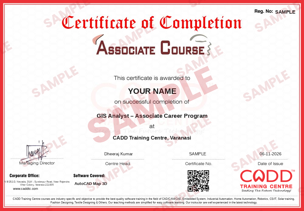

    Sample course-completion certificate — GIS Analyst – Associate Career Program
    Course-completion certificate (sample) — GIS Analyst – Associate Career Program · verifiable online
    Course-completion badge — GIS Analyst – Associate Career Program
    Course-completion badge
    Course
    GIS Analyst – Associate Career Program
    Issued by
    CADD Training Cetre
    Training
    Classroom or live online
    How to earn
    Complete the course and its project
    With your name and year · its own verify link · “Add to profile” on LinkedIn
  6. Certification exam

    Take the certification exam: a theory test and a practical task — at the centre or online.

  7. Certified certificate + marksheet

    Pass the exam and get the certified certificate with your marksheet. Anyone can check it online with its QR code.

  8. Certified badge

    Your certified badge — add it to LinkedIn and share it anywhere; it opens its own verify page.

    Certified badge — GIS Analyst – Associate Career Program
    Certified badge
    Course
    GIS Analyst – Associate Career Program
    Issued by
    CADD Training Cetre
    Training
    Classroom or live online
    How to earn
    Pass the certification exam
    You also get
    Certified certificate + marksheet
    With your name and year · its own verify link · “Add to profile” on LinkedIn
  9. Make your CV & apply for jobs

    Make your CV in your student panel (Career → My CV) — your course, certificates and projects are added for you. Send it as a link with a preview picture, and apply to jobs and Hire Me requests from companies.

About the AutoCAD Map 3D course

AutoCAD Map 3D brings GIS capabilities into AutoCAD. It lets you assign coordinate systems, connect directly to GIS data such as SHP files, databases, raster images and web map services, clean up drawings, build topology and create thematic maps, all without leaving a CAD workspace. Survey agencies, town planning departments, utility companies, land records projects and infrastructure consultants use it whenever map data must be delivered both as CAD drawings and as GIS files.

Over 80 hours, the course moves from GIS basics to a finished map project. You learn the Map Task Pane, Display Manager and Map Explorer, assign and transform coordinate systems, and use FDO Data Connect to bring in vector, raster and database sources. Drawing cleanup, object data tables, node, network and polygon topology, and drawing queries come next, followed by buffer and overlay analysis, styling with the Style Editor, legends and annotation, map books and export to GIS formats. You practise on real datasets in classroom batches at CADD centres or in live online classes and receive a CADD Training Centre certificate with online verification.

These skills are useful for roles such as GIS CAD technician, survey draughtsman, mapping executive and utility mapping engineer. Basic AutoCAD knowledge is expected; Civil 3D or a dedicated GIS program makes a strong next step.

You will be able to

  • Use the Map Task Pane, Display Manager and Map Explorer to manage map data
  • Assign and transform coordinate systems for drawings and GIS data
  • Connect to SHP, SDF, SQLite, raster and web map data with FDO Data Connect
  • Clean up drawings and build node, network and polygon topology
  • Query attached drawings and attach object data to features
  • Create thematic maps, labels and legends with the Style Editor
  • Run buffer and overlay analysis and publish map books

Who it is for

  • Surveyors and survey draughtsmen
  • Geography, GIS and remote sensing students
  • Civil engineers working on town planning, utilities and land records
  • AutoCAD users who need to work with GIS data

What you need

  • AutoCAD 2D knowledge is required
  • Basic idea of maps, scales and coordinates is helpful
  • For live online classes: a Windows PC with 16 GB RAM recommended

Courses that include AutoCAD Map 3D

GIS Analyst – Associate Career ProgramAssociate Career Program · 370 Hours · 4 software
Enquire →
Land Surveyor (CAD) – Professional Career ProgramProfessional Career Program · 394 Hours · 5 software
Enquire →
GIS Analyst – Professional Career ProgramProfessional Career Program · 490 Hours · 6 software
Enquire →
GIS & Mapping Technician – Professional Career ProgramProfessional Career Program · 474 Hours · 7 software
Enquire →

AutoCAD Map 3D Syllabus

10 chapters · 51 topics
01 Introduction to AutoCAD Map 3D and GIS 5 topics
  1. CAD and GIS: what Map 3D adds to AutoCAD
  2. Planning and Analysis workspace
  3. Map Task Pane overview
  4. Display Manager, Map Explorer and Map Book tabs
  5. Vector and raster data types
02 Coordinate Systems 5 topics
  1. Geographic and projected coordinate systems
  2. Assigning a coordinate system to a drawing
  3. Coordinate transformation between systems
  4. Library of coordinate systems
  5. Geolocation and online maps
03 Connecting to GIS Data (FDO) 6 topics
  1. Data Connect and FDO providers
  2. Working with SHP and SDF files
  3. SQLite and other database sources
  4. Inserting and correcting raster images
  5. WMS and web data sources
  6. Feature classes and schemas
04 Drawing Cleanup 5 topics
  1. Why clean drawings matter in GIS
  2. Delete duplicates and erase short objects
  3. Break crossing objects
  4. Extend undershoots and snap clustered nodes
  5. Dissolve pseudo nodes and simplify objects
05 Object Data and Attributes 5 topics
  1. Defining object data tables
  2. Attaching object data to objects
  3. Editing and exporting object data
  4. Linking to external database tables
  5. Converting object data to feature attributes
06 Topology 5 topics
  1. Node, network and polygon topology
  2. Creating topology from linework
  3. Editing and querying topology
  4. Shortest path and flood trace
  5. Polygon overlay basics
07 Drawing Queries and Project Management 5 topics
  1. Attaching source drawings
  2. Location, property, data and SQL queries
  3. Query modes: preview, draw and report
  4. Saving and reusing queries
  5. Saving changes back to source drawings
08 Feature Editing and Analysis 5 topics
  1. Creating and editing GIS features
  2. Checking out and checking in features
  3. Buffer analysis
  4. Overlay analysis
  5. Surfaces from DEM data and elevation styling
09 Styling, Thematic Maps and Annotation 5 topics
  1. Style Editor and scale ranges
  2. Theming by attribute values
  3. Feature labels and annotation templates
  4. Legends, north arrow and scale bar
  5. Layer styles and saving layers
10 Map Books, Export and Final Project 5 topics
  1. Map book templates and tiles
  2. Creating a map book
  3. MAPEXPORT and MAPIMPORT to GIS formats
  4. Plotting and PDF output
  5. Final project: utility or land-use map from raw data

Ratings & reviews

Students rate the course after they finish it — their ratings appear here.

AutoCAD Map 3D course — FAQ

What is AutoCAD Map 3D used for?

AutoCAD Map 3D combines CAD drafting with GIS. It is used to create and edit maps, connect to GIS formats like SHP, manage coordinate systems, build topology and prepare thematic maps for planning and utilities.

Who can join the AutoCAD Map 3D course?

Surveyors, civil engineers, geography and GIS students, and anyone who works with maps and land data can join. You should know basic AutoCAD drafting first.

How long is the AutoCAD Map 3D course?

The AutoCAD Map 3D course is 80 hours, covering coordinate systems, GIS data connection, cleanup, topology, queries, thematic mapping and map books.

Can I learn AutoCAD Map 3D online?

Yes. Pick a classroom batch at a CADD centre or join live online AutoCAD Map 3D classes; online, you work on the same GIS datasets on your PC while the trainer shares the screen.

What certificate will I get after Map 3D training?

A CADD Training Centre certificate is given after AutoCAD Map 3D. Each one carries a QR code and a unique number, letting a survey or mapping agency verify it online.

What is the difference between AutoCAD Map 3D and ArcGIS or QGIS?

ArcGIS and QGIS are dedicated GIS programs, while Map 3D brings GIS tools into AutoCAD. It is useful when map data must be drafted, cleaned and delivered as CAD drawings as well as GIS files.

What jobs need AutoCAD Map 3D skills?

Map 3D helps in roles like GIS CAD technician, survey draughtsman, mapping executive and utility mapping engineer with survey agencies, planning departments and infrastructure consultants.

More questions? Ask our counsellor or read the general FAQ.

AutoCAD Map 3D80 Hours
Enquire now